ܬܕܐuncertain [...]
ܓܝܘܪ]ܓܣ ܘܝܘ[ܚܢܢ...]
ܓܝܘܪ]ܓܣ ܘܝܘ[ܚܢܢ...]
Hover a word for its meaning. Glosses draw on Amir Harrak’s translations and the SEDRA 3 Syriac lexicon (Beth Mardutho), used for academic purposes.
Hover a word for its meaning. Glosses draw on Amir Harrak’s translations and the SEDRA 3 Syriac lexicon (Beth Mardutho), used for academic purposes.
(1) […]xx [… (2) …Gīwar]gīs and Yō[ḥannān …].
HB. Dukakin Caves
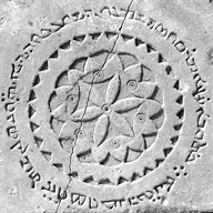
A cliff with rock-cut caves called Dukakin is located some 500 meters from Ain Sha’ia to its west side. Though the caves are naturally formed, some were restructured for the purpose of human, and probably monastic, habitation. Its proximity to Ain Sha’ia and its church, the fact that there are other cells and a spring of water nearby it, and most importantly, the discovery of a Syriac inscription in one of its caves, all indicate that the region in which these caves are found was inhabited by Christians during the Sassanian period if not slightly later. On the excavations see Fuji 1989, p. 27-88, and on the Syriac inscriptions and the Christian presence there see Hunter 1996, p. 74-80. I am very grateful to Dr. Hunter, for lending me the photograph of the inscription and for her excellent study of it.
| Date | Umayyad period |
|---|---|
| Language | Syriac |
| Script | Estrangela |
| Location Detail | Church, near the mud-brick pier wall separating the central from the right-hand aisle; Fuji 1989, p. 39. Museum No.: Not available. |
| Dimensions | One fragment measuring 0.08m x 0.07m |
| Periods / Eras | Umayyad period |
|---|